When it comes to holidays, we just tend to go with the flow. Actually, this road trip idea was decided on whim, just 3 days before our departure.
We knew that our final destination up North would be Rockhampton but did not think too much about how many days we would take. 3,4,5 days maybe? Who knows! We wanted to be adventurous and reward ourselves with a well-deserved end-of-year break.
Google Maps always give us a general idea of the roads and towns we could either skip, traverse or stop a little bit longer at. We just booked accommodation as we went.
We had one simple rule: to avoid the Bruce Highway as much as possible.
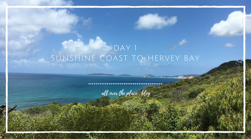
Day 1: Sunshine Coast to Hervey Bay (350 km)
Our road trip to the Capricorn Coast region started on Boxing Day, departing from the Sunshine Coast. We quickly exited the M1 to take the Cooroy/Poomona/Kin Kin Road in order to do some sightseeing along some of the charming fishing villages of the Great Sandy Strait.
Tin Can Bay
Tin Can Bay is a peaceful, fishing town where time seemed to have stopped.
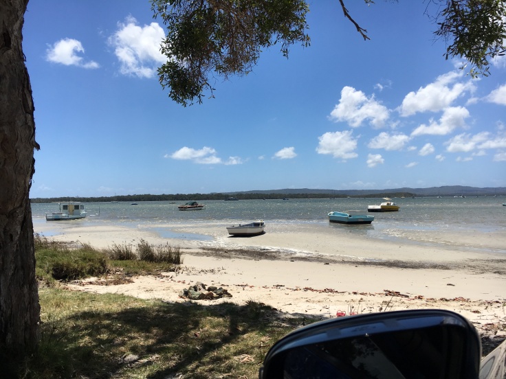
It was low tide when we arrived. As we walked along the esplanade and mangroves, looking at the near horizon, we could catch a glimpse of the Great Sandy National Park and the impressive sand dune of Rainbow Beach, called Carlo Sand Blow.
We were too late for the wild dolphins feeding session which takes place every day at the Dolphin Centre at 8am. Get more info here.
Rainbow Beach
Unlike Tin Can Bay, the town and the beach were jam-packed with 4WDs, families with kids running left and right. Indeed, Rainbow Beach is a popular point of departure for Fraser Island.
As soon as we arrived, we just wanted to run away from the buzz so we can enjoy a quieter spot, like the Carlo Sand Blow – so we thought.
Rainbow Beach has a sacred meaning in the local Aboriginal belief. It is such a shame that the majority of tourists do not take the time to appreciate its significance and treat the spot with respect and care…
Way back in Dreamtime, there lived on the banks of the Noosa River a beautiful black maiden named Murrawar, who fell in love with the Rainbow who came to visit her every evening in the sky. She would clap her hands and sing to this lovely rainbow.
One day, Burwilla, a bad man from a distant tribe stole Murrawar for his slave wife, often beating her cruelly and making her do all his work while he sat in the shade admiring his terrible killing boomerang. This boomerang was bigger than the the biggest tree and full of evil spirits.
One day, Murrawar ran away and as she hurried along near the beach, which was then all flat, she looked back and saw Burwilla’s boomerang coming to kill her. Calling out for help she fell to the ground too frightened to run. Suddenly she heard a loud noise in the sky and saw her faithful Rainbow racing towards her across the sea.
The wicked Boomerang attacked the brave Rainbow and they met with a roar like thunder, killing the Boomerang instantly and shattering the Rainbow into many small pieces.
Alas, the poor sick and shattered Rainbow lay on the beach to die, and is still there with all its colours forming the hills along the beach.
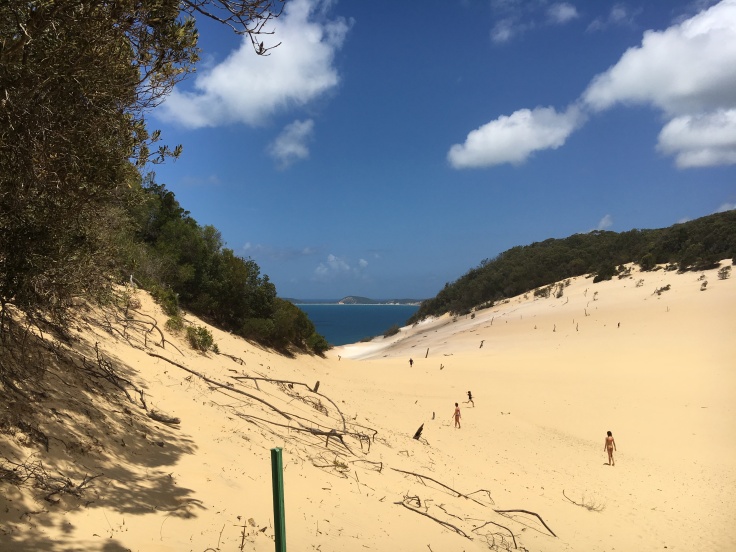
The walk from Rainbow Beach to Carlo Sand Blow was enjoyable and pretty steep. Alternatively, you can drive up to the car park and walk 600m to the spot.
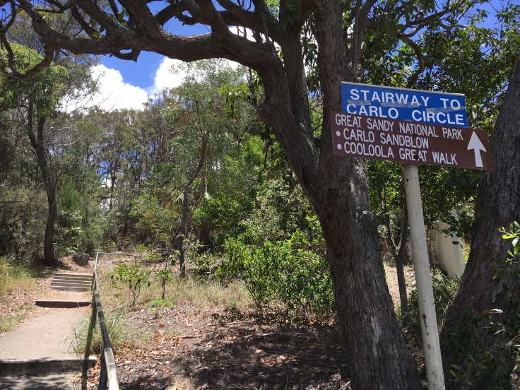
From the lookout, you can see the various bays which border the Great Sandy Strait. If you are willing to put up with the sand blowing in your face and eyes (which we were not for long) it is quite a unique location.
It actually inspired us to one day attempt the Cooloola Great Walk which departs from the same track.
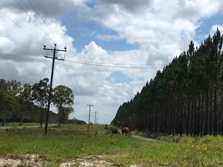
Back to the Toolara & Stuan State Forrest
After kilometres upon kilometres of pine trees, at the turn of the Maryborough Road and Tin Can Bay Road, 3 majestuous wild Australian horses, commonly called Brumbies, were standing out of the shade.
That was a first for us, an experience that we will always treasure as we felt privileged to observe these iconic Australian wild horses, just for ourselves.
Poona
As we drove in the direction of Maryborough, we made a detour via Poona first and then Boonooroo. In Poona, the tide withdrew so far away that we could walk for a couple of hundred meters on the mudflat.
Despite the sign next to the boat ramp to warn us against crocodiles, we still went it and gave our feet a natural (but oh-so smelly) mud treatment.
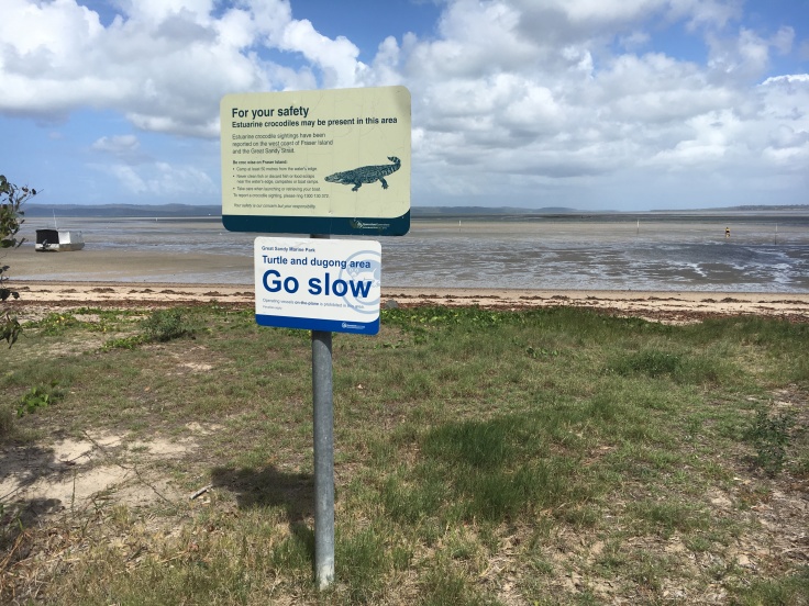
It almost seemed like we could walk all the way through Fraser Island. According to one of the fisherman we met, it is a great spot to catch some yabbies.
Hervey Bay via Maryborough
By mid-afternoon, we had already decided that we would spend the night in Maryborough.
We checked into our motel, had a quick shower to freshen up and made a reservation at the nearest seafood restaurant – anticipating that it would be probably booked out for a Boxing Day evening. We were pretty lucky as we managed to enjoy the sunset from The Vinyard Restaurant, overlooking the esplanade and The Pier in Hervey Bay.
It gave us a taste of what we would do the next day… to be continued here

This sounds so cool! Loved hearing about your trip!
LikeLiked by 1 person
Thank you YellowFuzzyDuck! I appreciate the positive feedback!
LikeLiked by 1 person
Fantastic adventure. Looking forward to reading more!
LikeLiked by 1 person
Article for Day 2 is coming up soon 😉
LikeLike
Loved reading about your trip. I especially enjoyed learning about the meaning of Rainbow Beach. Looking forward to reading more.
LikeLiked by 1 person
Thank you Jenny! Whenever possible I will try to include more Aboriginal stories. Australian history is multi-faceted 😉
LikeLike