Declared World Heritage in 1986, the Borders Ranges National Park is part of the identity, spirituality of the Githabul People. In November 2007, after a 12 year pursuit, the Githabul Nation was granted by the Federal Court of Australia native title rights and interest over 9 national parks and 13 state forests in Northern NSW, including the Borders Range National Park. This represents an area of 112,000 hectares. It was the first consent determination by the NSW Government for 10 years. The outcomes of this agreement not only include the rights of the Githabul People to freely practise their traditional laws and customs but also the management and protection of this breathtaking landmark.
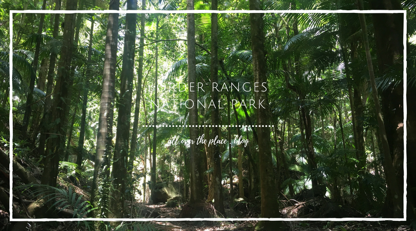
Located on the southern edge of the New South Wales (NSW) and Queensland (QLD) border, the Border Ranges National Park is the perfect gateway to the rainforests.
-
CONVENIENCE: 4/10
-
DIFFICULTY: 6/10
-
UNIQUENESS: 8/10
HOW TO GET THERE
The Rosewood Loop starts at Sheepstation Creek Campaign Area. It was a bit of an adventure for us to get to Sheepstation Creek so I am hoping this will make it easier for you:
From Kyogle: Head North on the Summerland Way for about 15km and then turn right onto Lynchees Creek Road then left onto Forest Road. Beware! As you as leave Summerland Way you will be entering gravelled road and stray cows territory so make sure you have some good tyres for this trip.


DISTANCES & Information
All visitors of the Border Range National Park must pay a park use fee of $8 per vehicle per day at the station. By paying fees, we are contributing to the cost of protecting the ecosystem of this National Park.
Considering we are experienced bushwalkers and stopped for about 20 minutes to have a lunch break, it took us 3 hours to complete the Rosewood Loop (6 km). It’s quite humid and dark in there. Some sections of the track are pretty hilly and have lots of steps.


WHAT’S SPECIAL ABOUT THE ROSEWOOD LOOP
- It’s a historical trail. In the mid-19th century, British settlers flocked to the Borders Ranges hoping to make a fortune from the red cedar tree, called “red gold”. There are giant stumps that can attest to this period. Within the first 15 minutes of the walk, you can see a big rock that cedar loggers carved their names into. Sheepstation Creek was the base for these fortune seekers and following the Rosewood Loop track allow us to walk in their footsteps.
- Learn your flora while walking. Like in a botanical garden, names and description of some trees are indicated on little signs to educate the visitors. Now I know what a Rosewood tree looks like in its natural habitat.
- We saw people swimming in the Rosewood Creek, near the Brushbox Falls but I would not recommend it as we were attacked by 6 leeches along the track.


BONUS – THE LIONS ROAD
If you live on the Gold Coast or Brisbane, take the Lions Road’s scenic drive back home. You won’t be disappointed!

Cela donne vraiment envie de découvrir ce bel endroit en évitant les sangsues…
LikeLiked by 1 person
J’étais un peu en panique quand la première est tombée sur moi. Juste un peu. Apres on s’y habitue et on garde son sang-froid (sans mauvais jeux de mots) 🙂
LikeLike
I have to say, I love that there are stray cows out there somewhere. That one looks genuinely rather surprised at seeing a stray human. 😄
LikeLiked by 1 person
I know, right! I like seeing animals with lots of space to themselves. There is something about cows that fascinates me. I reckon they are pretty smart animals.
LikeLiked by 1 person
They are quite gentle for their size too…and smart enough to know that if they let us have milk, they can live in beautiful pastures and eat grass all day. 🙂
LikeLike